Vigrestad
Vigrestad is a village in Hå municipality in Rogaland county, Norway. The village is located about 2 km northeast of the southwestern coast of Norway, facing the North Sea. The village sits about 7.5 km southeast of the village of Varhaug and about 3 km northwest of the villages of Hæen and Brusand.
Vigrestad Station is located on the Sørland Line, which runs through the village. The station is unmanned and only local trains stop there, not express or regional ones.
The 1.19 km2 village has a population (2019) of 2,090 and a population density of 1756 PD/km2.
The name probably has its origin from the word vig meaning "battle" or "war", and stad meaning "place". There is therefore reason to believe that it was the site of a battle. The name could alternatively originate from the Old Norse word "vigr" which means "spear". North of the village there are several barrows from the Iron Age and Bronze Age.
Vigrestad has been spelled in various ways over the centuries: Wirestad, Virestadt, Wiresteid in 1567, Vigrist in 1606, Wigresta in 1610, Vigrestad in 1616, and Wigrestad in 1723.
Map - Vigrestad
Map


Country - Norway
 |
 |
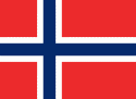
| Flag of Norway | |
Norway has a total area of 385,207 km2 and had a population of 5,425,270 in January 2022. The country shares a long eastern border with Sweden at a length of 1,619 km. It is bordered by Finland and Russia to the northeast and the Skagerrak strait to the south, on the other side of which are Denmark and the United Kingdom. Norway has an extensive coastline, facing the North Atlantic Ocean and the Barents Sea. The maritime influence dominates Norway's climate, with mild lowland temperatures on the sea coasts; the interior, while colder, is also significantly milder than areas elsewhere in the world on such northerly latitudes. Even during polar night in the north, temperatures above freezing are commonplace on the coastline. The maritime influence brings high rainfall and snowfall to some areas of the country.
Currency / Language
| ISO | Currency | Symbol | Significant figures |
|---|---|---|---|
| NOK | Norwegian krone | kr | 2 |
| ISO | Language |
|---|---|
| FI | Finnish language |
| SE | Northern Sami |
| NO | Norwegian language |
| NN | Nynorsk |